

Storm flooding affects homes, roads, businesses, and daily life across our coastal Southeastern VA communities.
<script async src="https://pagead2.googlesyndication.com/pagead/js/adsbygoogle.js?client=ca-pub-6545958482916591"
crossorigin="anonymous"></script>
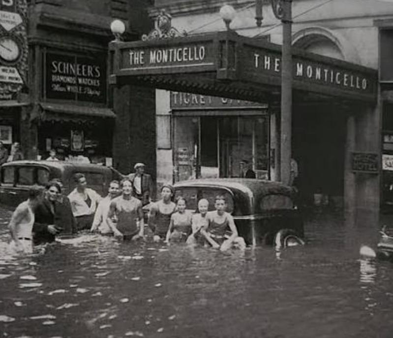
Source Citation: Photograph of downtown flooding on Granby Street during the Chesapeake–Potomac Hurricane of August 23, 1933, Norfolk, Virginia. Courtesy of the Virginian-Pilot Collection, Sargeant Memorial Collection, Norfolk Public Library.
Flooding is nothing new to Hampton Roads, but over the past year, we’ve seen more and more clearly how flooding can shut down businesses, close roads, and disrupt entire parts of our communities.
Large infrastructure projects are essential to addressing our region’s aging infrastructure, but neighborhood-scale solutions can also make a meaningful difference.
One piece of the problem is that during heavy rainfall, our stormwater infrastructure can become overwhelmed. We can’t always control how much rain falls—but we can help control how quickly that water reaches the storm drains.
Rain gardens, native plants, rain barrels, trees, and other green infrastructure can help slow, capture, and absorb stormwater where it falls, giving our drainage systems more time to handle the water.
And this becomes especially important when heavy rain arrives at high tide, when water has fewer places to go.
Flood resilience isn’t just about bigger infrastructure. It’s also about what we can do, yard by yard and neighborhood by neighborhood, to help our communities handle the water.
When your street becomes a river…
A Norfolk resident recently took a jet ski down a flooded street after a major storm — and while the video is certainly wild, it also highlights just how much water our infrastructure can be dealing with during extreme rainfall.
Flooding in Hampton Roads isn't just an inconvenience. It can shut down roads, businesses, and neighborhoods.
We need to keep talking about ways to slow, capture, and manage stormwater — from rain gardens and rain barrels to larger infrastructure improvements.
"Lake Onley" has been flooding for decades, as have many noted roads in Norfolk, VA.
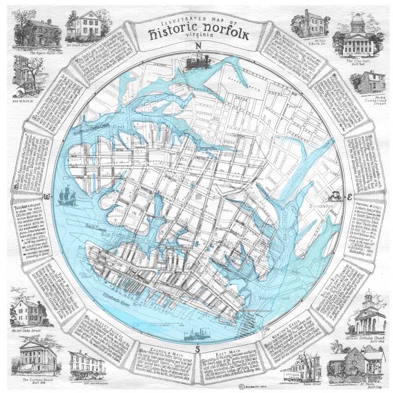
Historical map: Illustrated Map of Historic Norfolk, Virginia, D.H. Smith, 1944.
The map illustrates the waterways and historic landscape of Norfolk before many areas were substantially altered by later development.
🌿Stay Informed with the Latest Updates in Resiliency Gardening
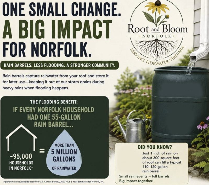
We promote practical solutions such as:
-
Rain gardens that capture and filter stormwater
-
Rain barrels that reduce runoff during storms
-
Native plants that improve soil absorption
-
Tree canopies that slow the rain hitting the streets
-
Permeable landscaping techniques
-
Community education about stormwater solutions
Please check out our Recommended Products and Retailers below.
Every yard can become part of a larger network of protection.
🌿Resiliency Resources
Rain Garden Starter Guide
Want to reduce flooding, improve water quality, and create habitat for pollinators? Rain gardens capture and filter stormwater runoff before it reaches local waterways.
Resource provided by the Virginia Department of Forestry. All rights remain with the original publisher.
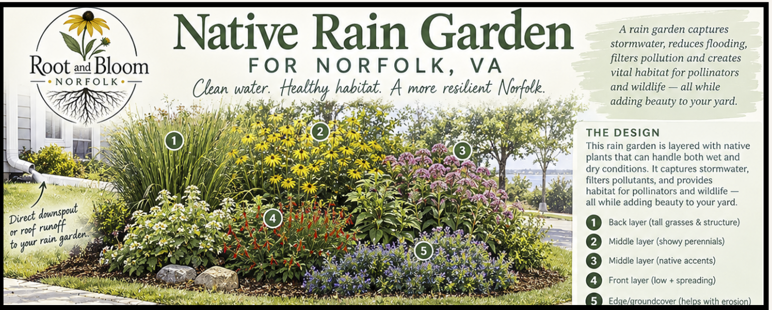
Native Rain Garden Plan
A simple rain garden plan complete with plant tips and planning ideas.